On March 31st myself and MR. D went out on a nice long hike up in Southwestern Mass. It was decided based on some extensive research to go up into Mass. and try out a long hike in Washington State Park. The route that we were going to take would take us from Mass into NY and then back into Mass, but somewhere along the hike we missed a turn so we followed 3 different trails. The first trail was the Alender Mountain trail which would take based on it's name to the top of Alender Mountain. We did get to the top of the mountain but it was after hiking over 2 other mountains that we didn't even know the name of. The next trail was the Ashley Hill trail which took us to the South Taconic trail. This last one we both believed took us into New York and then brought us back into Mass. Atleast that's what we think happened because based on the trail map that we grabbed at the trail head we were off the map. By the way that trail map sucked. It was usefull somewhat just so we could match up different trail intersections that we came to but other than that it sucked. It would have been nice to have a nice topo map that we could have used to find out where exactly we were because Mr. D's gps would tell us the spot we were at but because the trail map sucked we had to almost guess based on terrain features that were around us. No big deal though becaue we plotted our starting point so if anything would have gone wrong or if we got lost all we had to do was head back toward the starting point and it would be ok
The weather outside wasn't bad. We acutally lucked out because by the time we got off the trail 5 hours after we started, it was snowing. Speaking of snow during the hike we actually debated whether or not snowshoes would have come in handy but we both decieded that no, they would have been a pain beause we would have just had to keep on taking them off and putting them back which is a pain.
The trails where covered in snow and abosolutely muddy as shit. This is probably due to the fact that most of the trails we were on just followed a pretty substantial stream so there was a lot of run off, but the feet didn't get too wet which is a good thing, wet feet suck. Thank god we both had some good Merrell boots that we good to hike in. The one thing we noticed was all the downed trees, it was almost like the were frozen and fell over beause alot of them looked as if they had shattered upon hitting the ground. This made for some fun hiking because it was like an obstacle course, going up and over, underneath, around all these fallen trees, almost like the tough mudder! Almost.
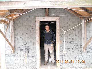
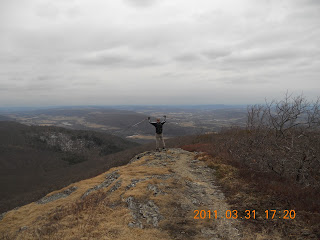
So, anyway we were hiking for awhile when we stopped and had an energy bar, which by the way these things were awesome. Both of us only ate 2 each and they sustained us for the entire hike even though Mr. D brought his Jetboil and we both had 2 Moutain House meals to eat if we got really hungry. After we stopped we started up another trail because the one we were on was going to take us down into a valley where we would have had to climb back up a ridgeline to the top of a mountain which we didn't want to do so we broke off onto another trail to hopefully at some point find this elusive mountain named Alender, which at a couple of different points I started to think didn't exist. So we kept on hiking. Based on what the gps told us and what the trail map said we should have come upon the Alender Mountain shelter, which again I started to think didn't exist. When we finally did come upon we where like WOW this place looks like some where you would kill a person, but inside was pretty neat. There were bunk beds and a wood stove so it was pretty neat. The shelters on the AT don't have any of this. They are enclosed on 3 sides and have a roof. This was pretty much a house in the middle of the woods. It was funny reading some of the stuff that people wrote inside the log book. People write all sorts of weird stuff when they are out in the middle of nowhere drunk and in a cabin. We hung out here for alittle bit, took some pictures and then headed up to the top of Alender Mountain. Once we got up to the top we again took some pictures and started hiking North. However, probably about 10 minutes later we both agreed that we were going in the wrong direction because we should have taken a hard right behind the cabin to start heading Southeast which we weren't doing. So we stopped took out the trail map and backtracked back the top of Alender Mountain where there was a sign that I think our good friends that stayed up at the cabin moved. So we go back down to the cabin and find the correct trail marked with a blue diamond blaze and pretty much followed that all the way back to the trail head. Total distance was somewhere around 10.1 miles. Not to bad for 5 hours of walking through the woods. What was weird though is I only heard 3 birds and 1 owl the whole time. I think the animals were like screw this it's too cold let these dumb humans walk. Another weird thing we noticed was when we came to the top of the first mountain it was dead quiet. Like the kind of quiet that is in a scary movie right before someone gets butchered by the bad guy. There was no wind, no noise, no nothing. This changed when we got to the top of Alender Mountain, it was like being in a wind tunnel. On all the mountains we summitted there was so much scrub brush that is was hard to take pictures, I couldn't see over any of it because of my short mighty dog legs, but that's for another time when I will talk about how I have been cheated in life being so short and that I haven't been able to realize any of my dreams, which I will blame on my parents and then go to therapy for. Probably not but it would be funny. It's weird when you are walking in all that scrub brush because it's so thick and it's almost feels like your walking inside a maze like in Harry Potter and the Goblet of Fire. Yes I just made a reference to Harry Potter he is my hero. When you walk in the forrest you can see because there is space between the trees but not in the scrub brush you can't see anything until you come out on top of a rock or something, so little furry creatures out there if you are reading this, the scrub brush would be a great place for an ambush, just saying.
Overall it was a good day and a great hike, we will definitely be going back up there again to get lost in the woods. Here some pics from the hike, sorry they aren't more clear but it was an overcast day out. Enjoy
 |
| beginning of the hike |
 |
| this is the trail, lots of downed trees |
 |
| 2nd trail we used, this took us into New York State |
 |
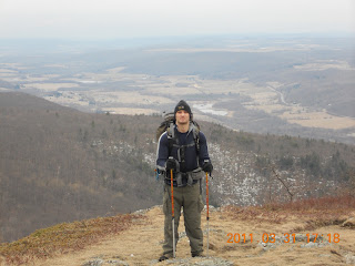
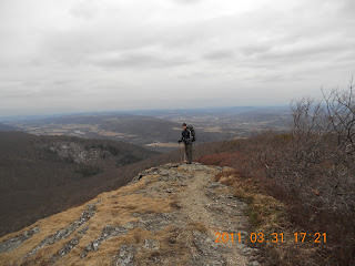
| Notice all the scrub brush, made it hard to see along with the overcast skies |
 |
| On top of some mountain? |
 |
| believe in the distance that is Mt. Everett to the east |
 |
| thought it looked neat so I took a pic |
 |
| Valley below |
 |
| better pic of valley |
 |
| some cool peaks in the distance |
 |
| follow the sign |
 |
| Neat little cabin on Alender trail |
 |
| is it really though? |
 |
| log book, fun to read |
 |
| that door was 10ft tall, Mr. D monster |
 |
| yes I am short |
 |
| people messed with this and we ended up hiking the wrong direction for a little bit |
 |
| again follow the sign |
 |
| top of Alender MT |
 |
| Top of Alender Mt |
 |
| Adrian!!!!!!! |
 |
| 3rd trail we followed |
Here is the gps stats from this hike, just click the link and it will set you free


No comments:
Post a Comment